
The research project ENGINEER (Civil Engineering and Geomatics Innovative Research on Heritage) has been completed after three years of implementation, making a substantial contribution to strengthening Cyprus’s research and technological activity in the field of digital cultural heritage, through geoinformatics and civil engineering technologies. The project was funded by the Horizon Europe – Twinning (HORIZON-WIDERA-2021-ACCESS-03) programme of the European Union and UK Research and Innovation (UKRI), with the Cyprus University of Technology (CUT) as coordinator.
The consortium included the Politecnico di Milano (POLIMI), the University of Aveiro (UAVEIRO), University College London (UCL), and the ERATOSTHENES Centre of Excellence (ECoE). The main objective of ENGINEER was to strengthen the research capabilities of CUT through collaboration, knowledge exchange and the development of interdisciplinary approaches that combine geoinformatics, civil engineering, and digital documentation technologies.
The project was based on the need to enhance the Department of Civil Engineering and Geomatics of CUT, aiming to strengthen its research presence in areas such as three-dimensional documentation, non-destructive diagnosis, and risk analysis for monuments. In line with the priorities of the Smart Specialisation Strategy of Cyprus (S3CY), ENGINEER contributed to establishing cultural heritage as a central axis of sustainable development, making use of the potential offered by digital technologies and education.
Through the collaboration of four CUT research laboratories – the Earth Observation Cultural Heritage Lab (EOCult), the Laboratory for Structural Assessment and Concrete Construction Innovations (HEPHAESTUS), the Photogrammetric Vision Lab, and the Geospatial Analytics Lab (GeoSpAL) – the project helped shape a unified research identity that combines remote sensing, photogrammetry, and structural analysis data, enhancing methodological coherence and interdisciplinary collaboration.
Education, Mobility and Knowledge Exchange
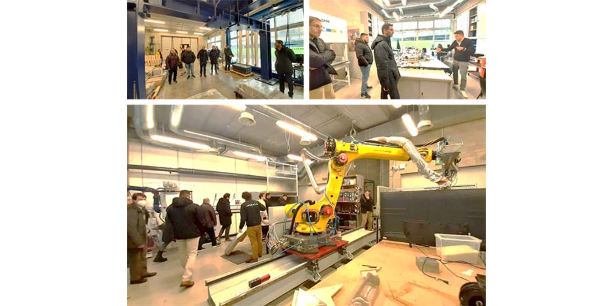
During the project, five thematic workshops and three summer schools were organised, which formed key pillars of training and exchange of experience among the partners. These activities covered a wide range of topics, from three-dimensional modelling and structural assessment to cultural heritage information systems.
Researchers and students from CUT were trained in collaborative workshops held in Italy, Portugal and the United Kingdom, while at the same time, members of the partner institutions were hosted in Cyprus for joint field activities. The training included hands-on familiarisation with technologies such as photogrammetry using unmanned aerial vehicles (UAVs), laser scanning, thermal and spectral imaging, vibration sensors, material analysis, and digital twins.
Of particular importance were the field activities carried out at the Tombs of the Kings, a UNESCO World Heritage Monument, where combined data from satellite and UAV remote sensing, terrestrial scanning, environmental monitoring, and laboratory analyses were applied. The results of these activities were used to create three-dimensional models and to simulate decay and seismic vulnerability of the monuments, providing valuable data for their conservation.
Research Results and International Recognition
The project led to the production of significant scientific results, with publications in international journals and presentations at conferences on cultural heritage, geoinformatics, and remote sensing applications. Researchers from CUT and the partner institutions participated in international events such as ISPRS, CIPA, DBAR, NASA Archaeology from Space, SAHC, and IEEE IGARSS, presenting the outcomes of their joint activities.
The experience of ENGINEER served as a springboard for the participation of CUT in new research projects such as CONNECTING, ARGUS, COASTLINE, and Wat[H]ER, focusing on remote sensing infrastructures, mobility of young researchers, and heritage monitoring. The total budget of the collaborations that emerged exceeds €10 million, reflecting the continuity and sustainability of the actions initiated by ENGINEER.
Social Dimension and Knowledge Dissemination
Beyond its research outcomes, ENGINEER developed significant activity in the field of education and public awareness. Through initiatives such as Researchers at School and the European Researchers’ Night, students, citizens and local stakeholders were introduced to the potential of digital technologies for documenting and managing cultural heritage.
At the same time, information events were organised in collaboration with the Department of Antiquities of Cyprus, the Scientific and Technical Chamber of Cyprus (ETEK), ICOMOS Cyprus, and other public and private organisations. These actions contributed to strengthening the relationship between research and society, promoting the sustainable use of cultural heritage.
The project’s online presence, through its website www.engineer-twinning.eu and open data repositories (Zenodo, KTISIS), enhanced transparency, collaboration, and the adoption of open science practices.
Legacy and Continuity
ENGINEER has served as a starting point for the development of a comprehensive research and innovation framework in Cyprus in the field of cultural heritage. It strengthened research infrastructures, fostered new skills, and highlighted the importance of interdisciplinary collaboration.
With its completion, the project leaves behind a meaningful legacy: a stronger research ecosystem, a new generation of scientists with international experience, and a network of collaborations that connect Cyprus with the European research community.
More information:
🔗 https://engineer-twinning.eu
Source: Cyprus University of Technology | News and Announcements (https://tinyurl.com/yazvhrxh)